資料名 |
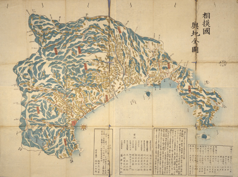
The Entire Map of Sagami Province |
作者 |
unknown |
解説 |
Kikuya Edition Production date: 1840s This is a map of Sagami Province. Yochi zenzu indicates the entire picture map of that region and there were several “Yochizu” or officially published maps including this “Kikuya Edition”. “Sagami” was the name of the province, or present day’s prefecture, established during the Edo period. In the matter of scale, it is followed by gun (counties), then mura (village) that constructed the unit of people’s life. The names of places are indicated in the oval coin shape signs. The name of river, famous scenic places and landmarks are illustrated in detail. The place painted in bluish green is mountainous region and the peak of Enoshima Island’s is also painted with this color. |
資料番号 |