資料名 |
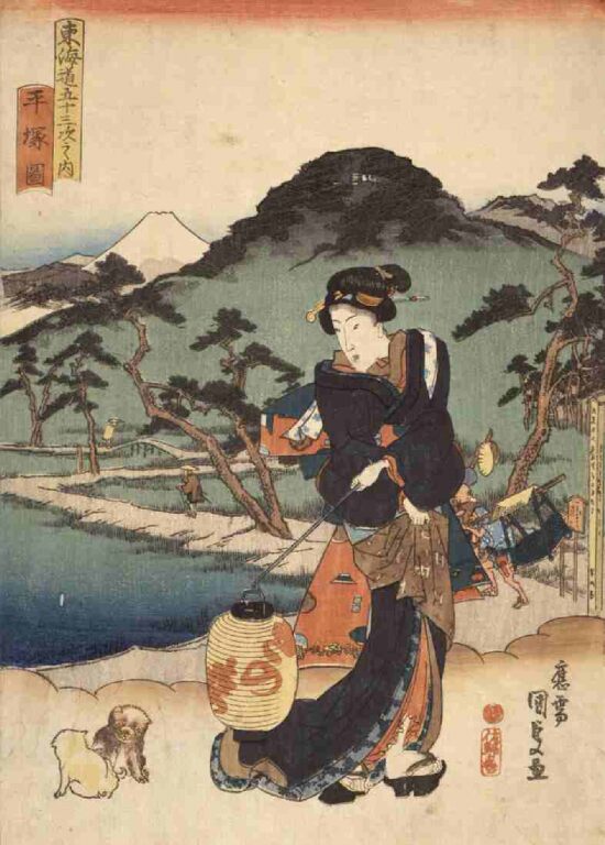
Hiratsuka from the series “Fifty-three Stations of the Toukaidou Highway” |
解説 |
Utagawa Kunisada(Utagawa Toyokuni Ⅲ) 1833 A foot path between rice fields that extends toward the mountains is illustrated in the middle of picture. The various shapes of mountains, the round Mt. Koma on the middle, Mt. Oyama composed with the sharp corners on the right, and the Mt. Fuji in the left are illustrated. From a boundary guidepost that indicates the entrance and exit of the post station illustrated in the middle, it is suggested that this place is the west end of the Hiratsuka post station (Oiso post station side). |
資料番号 |
10342 |