資料名 |
Famous Places Japan |
解説 |
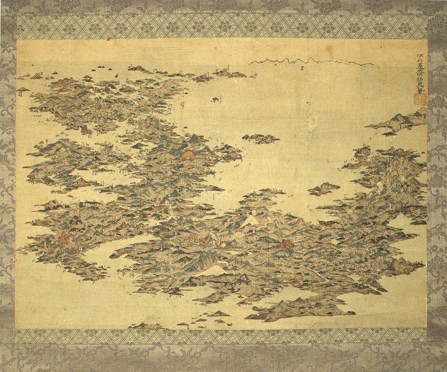
Kuwagata Keisai 1804-18 This is a chōkan-zu (bird’s-eye view illustration) depicting famous spots throughout Japan. The overall shape of Japan is compressed and reshaped to fit within the bounds of the composition, and the island of Honshū is featured in the foreground with domain names, castle names, and famous sights noted in great detail. In the region labeled “Sagami” near the bottom, an island resembling Enoshima can be seen. This bird's-eye view depiction of Japan seems to have been rare at the time, and even Katsushika Hokusai imitated it, applying this composition to his work Tōkaidō Meisho Ichiran (Views of Famous Places Along the Tōkaidō). This ezu (illustrated map) was created by Kuwagata Keisai (also known as Kitao Masayoshi), who was a pupil of Kitao Shigemasa. At the age of 31, Kuwagata would go on to become a commissioned artist under the Tsuyama Domain (part of present-day Okayama Prefecture) in 1794 and changed his name to Kuwagata Keisai Tsuguzane. |
資料番号 |
70917 |