資料名 |
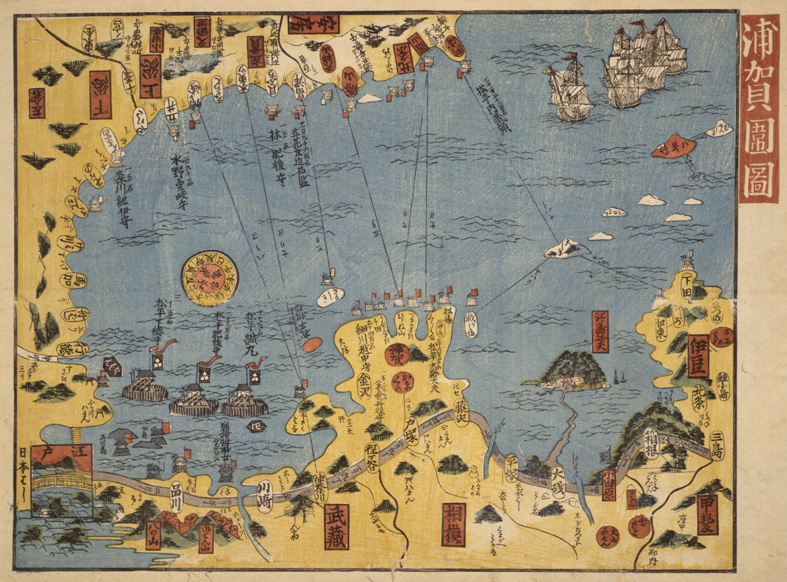
Uraga Kakoizu (Military Defense Map of Uraga) |
解説 |
Artist Unknown 1854 The sensational incident of Commodore Perry’s arrival, better known in Japan as kurofune raikō or the “arrival of the black ships,” brought great tension within the Edo government. In response, the government strengthened the coastal defense along the Bōsō peninsula, through the Edo capital, and south into the Miura peninsula. The map or diagram depicting the coastal defense was called an “Okatame-zu.” The coastline was protected by several fudai daimyō (feudal lords that had generationally been loyal to the Tokugawa regime even prior to their rise to power) from all over Japan. This map shows the defense line around the capital. Odaiba was a fort built to defend the shores closest to the Edo capital. Watch towers, cannons, and flags with the daimyō family crests are illustrated within the diagram. |
資料番号 |