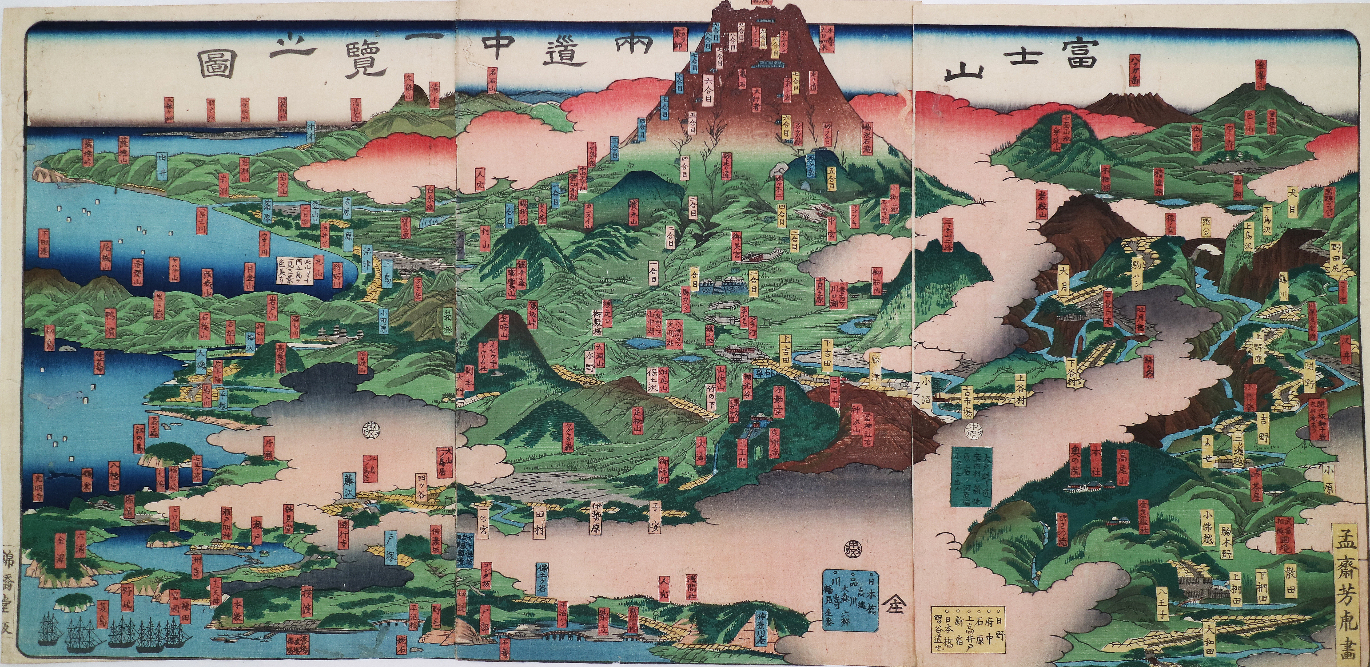
Fujisawa Net Museum

資料詳細

一覧へ戻る

資料名しりょうめい

Map of Routes on Both Sides of Mount Fuji

作者さくしゃ

Utagawa Yoshitora

解説かいせつ

Utagawa Yoshitora
1860

This work is painted in a manner to make the Tōkaidō and Kōshū Kaidō post road routes leading to Mt. Fuji clear to the viewer. The yellow tags indicate stations on the Kōshū Kaidō, and the blue tags, stations on the Tōkaidō. The red tags are inscribed with the names of sacred places, temples, and shrines. This painting was made in 1860, which corresponded to the 57th year in the sexagenary cycle. It is therefore thought that it was published in time for use in this year, which is associated with Mt. Fuji.
The portrayal of Fujisawa at lower left contains the inscriptions “Yugyō-ji Temple” and first torii on Enoshima, with depictions of a small torii and Daigiribashi Bridge (the present-day Yugyō-ji Bridge). Also, Yotsuya, adjacent to Fujisawa, depicts the characters first torii Ōyama and a torii, suggesting that the torii gates standing at the Yotsuya intersection (now around Jōnan, Fujisawa City) was recognized as the starting point of the Ōyama Road at that time.

資料番号しりょうばんごう


Page Top